- Home
- Places
- Activities/Tours
- Foodies
- Hotels/Resorts
- Protected Areas
- Home
- Places
- Activities/Tours
- Foodies
- Hotels/Resorts
- Protected Areas
- Important Info
Now Reading: Discover the Fascinating Geography and Climate of Belize: A Tropical Paradise Unlike Any Other!
1-
01
Discover the Fascinating Geography and Climate of Belize: A Tropical Paradise Unlike Any Other!
Discover the Fascinating Geography and Climate of Belize: A Tropical Paradise Unlike Any Other!

Belize is known for its stunning natural beauty and diverse geography. Nestled between Mexico to the north, Guatemala to the west and south, and the Caribbean Sea to the east, Belize covers an area of approximately 8,867 square miles (22,965 square kilometers). The country’s geography is characterized by a diverse landscape that includes low-lying coastal plains, dense jungles, and the majestic Maya Mountains.
The coastline of Belize stretches for more than 240 miles (386 kilometers) along the Caribbean Sea, boasting the longest barrier reef in the Western Hemisphere. The Belize Barrier Reef, a UNESCO World Heritage site, spans 190 miles (306 kilometers) and is home to a staggering array of marine life, including over 500 species of fish and more than 100 different types of coral. This natural wonder also encompasses several offshore atolls and hundreds of small islands, known as cayes (pronounced keys), which provide idyllic settings for snorkeling, scuba diving, and other water-based activities.
Inland, the northern and central regions of Belize feature relatively flat and low-lying terrain, with vast expanses of savanna and marshland. These areas are primarily used for agriculture and are home to a variety of plant and animal species. In contrast, the southern and western regions of Belize boast a more rugged topography, with the Maya Mountains dominating the landscape. The highest peak in Belize, Doyle’s Delight, reaches an elevation of 3,688 feet (1,124 meters) and is found in this mountain range.
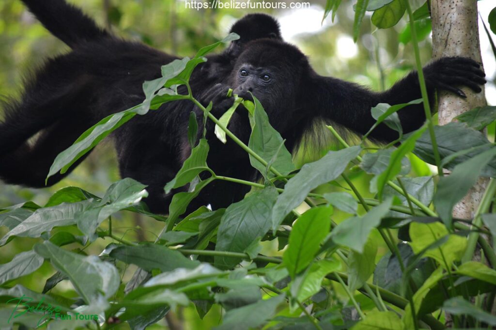
The thick, lush jungles of Belize provide sanctuary to a rich diversity of flora and fauna, including over 4,000 species of flowering plants and more than 600 types of birds. Belize is also home to several large mammals, such as jaguars, pumas, and tapirs, as well as various species of monkeys, reptiles, and amphibians. The country’s commitment to conservation and ecotourism has resulted in the creation of numerous national parks and protected areas, encompassing roughly 26% of Belize’s landmass.
Belize’s climate is classified as sub tropical, characterized by distinct wet and dry seasons, high humidity, and relatively stable temperatures throughout the year. The coastal areas experience a maritime influence, with cooling sea breezes providing relief from the heat and humidity. The average annual temperature ranges from 77°F (25°C) in the coastal regions to 71°F (22°C) in the inland highlands.
The wet season in Belize typically runs from June to November, with the heaviest rainfall occurring in the south. During this time, the country experiences frequent showers and occasional tropical storms, which can result in localized flooding. The dry season, which spans from December to May, brings drier and sunnier conditions, making it the preferred time for tourists to visit Belize.
Belize is also susceptible to hurricanes, with the Atlantic hurricane season officially running from June 1st to November 30th. The country has experienced several devastating hurricanes in its history, including Hurricane Hattie in 1961, which caused widespread destruction and loss of life.
The diverse geography and climate of Belize have shaped its rich cultural and natural heritage, attracting visitors from around the world who are drawn to its pristine beaches, vibrant reefs, and dense jungles. As the country continues to prioritize conservation and sustainable development, Belize’s unique landscape and ecosystems remain a source of pride and wonder for both locals and tourists alike.
Related Posts
Stay Informed With the Latest & Most Important News
Previous Post
Next Post
DonationsEco-Tourism2 months ago
Lamanai Belize
Belize Archaeological Reserves8 months ago
Xunantunich
Deal Of The MonthCategoriesLoading Next Post...Scroll to TopPopular Now-
 01Discover Belize’s Hidden Gem – Cockscomb Basin Wildlife Sanctuary
 -
 02The Community Baboon Sanctuary: Unmasking the Primate Haven
 -
 03Belize All-Inclusive Resorts: Your Ultimate Guide to Paradise
 -
 04The Belize Barrier Reef: A UNESCO World Heritage Site
 -
 05Xunantunich
 -
 06The Best Time to Visit Belize: A Comprehensive Guide
 -
 07Caracol Belize
- Activities/Tours
- Activities/Tours


